Skip to content

Learn More

ABOUT US

The Framework

The potential of using unmanned aerial means in the management of forest fires, in their detection and monitoring phases, is widely recognized. However, several limitations to there use are pointed out, such as the interference with other firefighting aerial means flying at the same altitude range and the low endurance of these equipment with typical flight autonomy below 30 minutes. The proposed solution aims to make the most of unmanned aerial means in fire management, minimizing the aforementioned limitations.

Concept

overview

The global solution will be available as a launch kit including a balloon launch tool (to maximize the field of action during the fire), as well as all the necessary material for launching the platform ( HAB + UAV + observation and/or communication payloads) and their placement at high altitude over the area of interest. This solution allows the operational platform to be deployed in a short period of time, so that communications and transmission of aerial images are promptly guaranteed.

Eye In.

The Sky.

The Eye in the Sky Project intends to complement other aerial solutions, such as the manned aircraft or cooperative drones, used in emergency situations. While the usual UAV-based solutions provide local and more detailed information of the monitored areas, the Eye in the Sky Project offers more extensive communications coverage and a wider general aerial view due to the higher altitude of operation.

When transported by the HAB, the flying wing UAV’s operational capacity increases due to the potential energy accumulated at high altitude. This solution will allow long-range flights without an engine or almost without power, converting altitude into land coverage.

Within the scope of this project, the payloads considered are used for image acquisition and communications repeater. Other monitoring applications, continental or oceanic, in the civil or military scope, can benefit from this HAB + UAV tool and the overview it offers. Its versatility allows this tool to support both the collection of scientific data and the ability to monitor disasters, contributing significantly to the increase in knowledge in the National Scientific and Technological System.

Other related projects

Projects with Protocol

Firefront_Eye-In-The-Sky

The Firefront project will develop a solution to support firefighting actions in forest fires through the real-time detection and tracking of fire fronts and reburns.

Related Projects

FireLOC

Identification, positioning and monitoring forest fires with crowdsourced data.

FoCor

Using Unmanned Aerial Vehicles to Assist Prescribed Fires and Detect Rekindles in Wildfire Management

HEIMDALL

Integrated tools for emergency planning and management, addressing the needs of the involved first responders (firefighting units, police departments, medical emergency services, civil protection units and command and control centres) and relevant stakeholders in terms of interoperability, inter-organisational coordination and information sharing.

FireRS

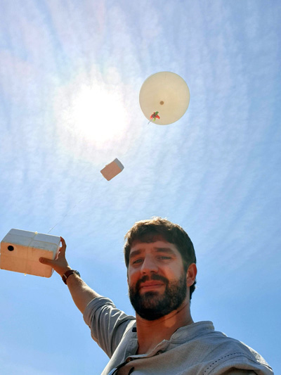
FireRS aims to provide emergency agencies and / or coordination centers with an innovative tool for detecting and managing fire using new technologies. (The new platform created in FireRS will provide almost real-time information, GPS positioning, fire perimeter, infrared images, propagation prediction, performance protocols, etc. The set consists of ground sensors, a dedicated picosatellite, a local and remote ground station as well as a mission control center.)

RESCuE-TOOL

In this research project, the study of radiowave propagation phenomena in the presence of wildfires, is proposed. Both experimental and theoretical approaches to examine and understand radio propagation in fire environments for various scenarios and fuel heaps that are problematic to radio communication will be examined and a new radio system planning will be studied and implemented in real case applications. Discussion and recommendations will be made concerning radio communication frequency selection and considerations for both SIRESP radio coverage.